


 274 326

274
October14
What is it?
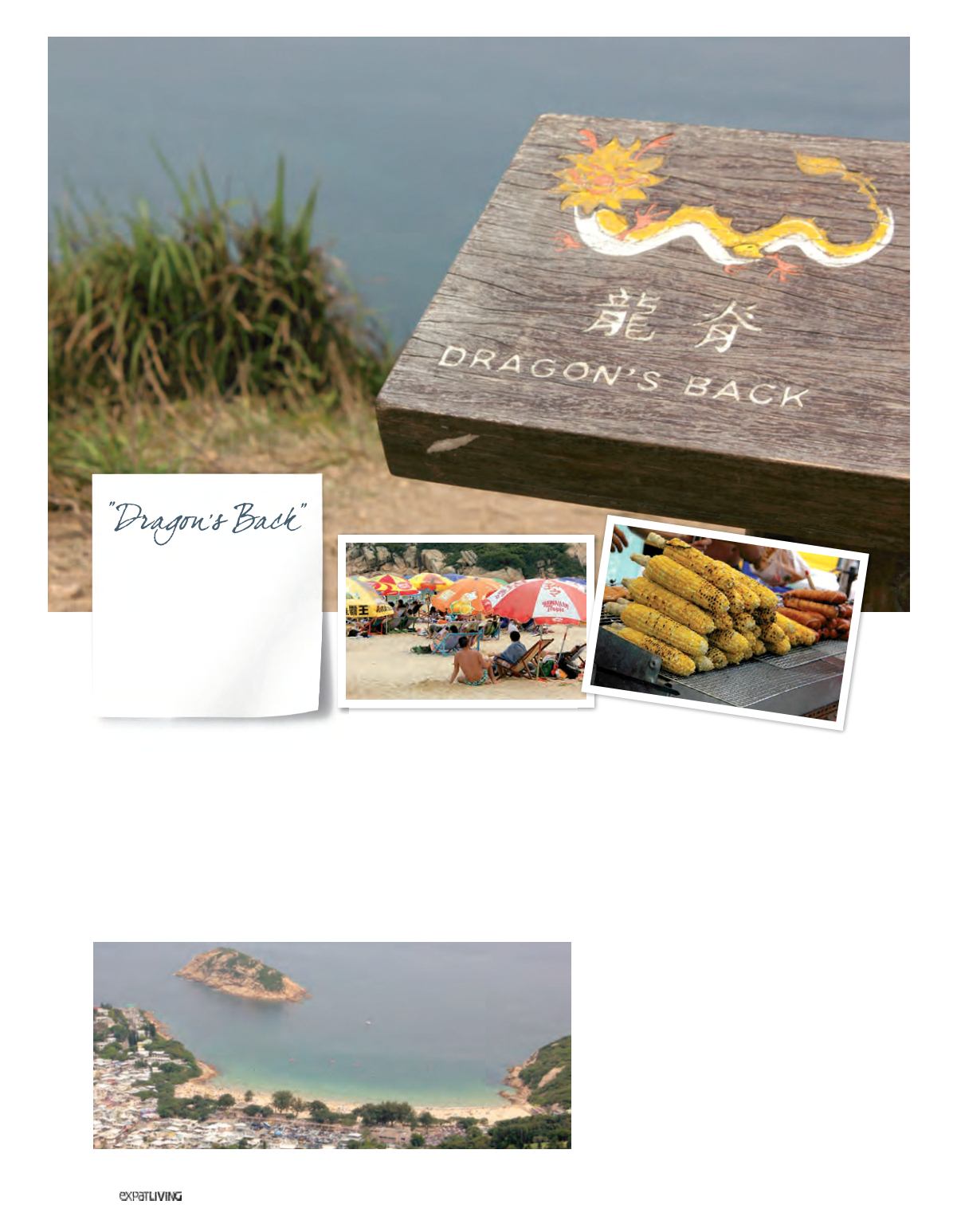
It’s been 10 years since this stunning path
on top of the southeastern peninsula of
Hong Kong Island was named Asia’s
best urban hiking trail by
Time
magazine.
A lot of boots have trudged along its
undulating hills since then, including
around a zillion on the day I did it. It was
a public holiday, though, so I should have
seen it coming; you could almost hear the
dragon groaning from the weight.
What’s good about it?
Happily, the crowds don’t matter. You
still get glorious, unimpeded views of
the South China Sea and Hong Kong
Island’s various bays and beaches –
especially from Shek O Peak (284m).
Who’s doing it?
Weekend sightseers, community
groups, families. Try a weekday morning
if you prefer a bit of solitude.
What’s at the end of it?
The beach! There are two options: you
can either stop at Big Wave Bay, known
for its decent surf break, or continue on
to Shek O, where families enjoying late
afternoon barbecues and ball games
are the order of the day. There are
plenty of places to eat, drink and buy
provisions at both villages.
How do you get there?
Easy options include driving or taking
a taxi (around HK$150 from Central). If
you’re relying on public transport, follow
these steps:
•
Go on the MTR Island Line from
Central to Shau Kei Wan (20 minutes).
•
Take Exit A3, then board bus 9 from
Shau Kei Wan to To Tei Wan.
•
The stop is 11 stops or 6km along
the route, on Shek O Road near To
Tei Wan village. Ask the bus driver or
a fellow passenger if you’re not sure
where you are.
HONG KONG TRAIL
(Sections 8)
Location:
Shek O Country
Park, on the eastern side
of Hong Kong Island
Length:
8-9 km
(around three hours)
Level:
Easy to moderate